Purnia, Bihar: The Gateway to Northeast Bihar
Purnia, with its headquarters in Purnea town, is a vibrant district in Purnia Division, known as the agricultural heartland of northeast Bihar, nestled along the Kosi and Mahananda rivers. Established by the East India Company in 1770, it is a major jute-producing region and a cultural hub with landmarks like Puran Devi Mandir and Jalalgarh Qila. Bordering West Bengal and close to Nepal, Purnia blends agrarian traditions with industrial growth, governed by the Purnea Municipal Corporation.
Basic Details of Purnia District
- Location: Purnia district is situated in northeastern Bihar, part of the Seemanchal region, between 25.47°–26.35°N latitude and 87.00°–87.78°E longitude, at an average elevation of 52 meters (171 feet). It lies in the fertile Gangetic plains, close to the Indo-Nepal and Indo-Bangladesh borders.
- Administrative Status: Purnia is the headquarters of Purnia district and part of the Purnia division, which includes Purnia, Katihar, Araria, and Kishanganj. Purnia city is a municipal corporation and a major urban and commercial center.
- Population: As provided, the district’s population is 32,64,619 (2011 census), with Purnia city at ~282,248 (urban). The density is 1,011 persons/km², moderate for Bihar, reflecting a mix of urban and rural areas.
- Area: The district spans 3,229 sq. km, supporting agriculture, urban centers, and historical sites.
- Nickname: Purnia is known as the “Mini Darjeeling” for its pleasant climate and proximity to Himalayan foothills, and the “Grain Bowl of Bihar” for its agricultural productivity.
1. Formation and History
- Formation:
- Purnia district was formed in 1770 by the East India Company, making it one of Bihar’s oldest administrative units. Established for revenue collection and trade control, it was carved out from the larger Bengal Presidency.
- The district’s boundaries have evolved, with Araria and Kishanganj carved out in 1990 to improve governance in the Seemanchal region.
- Historical Significance:
- Ancient Period:
- Purnia was part of the ancient Anga and Mithila regions, mentioned in the Mahabharata and Buddhist texts. It was a trade hub connecting the Gangetic plains to the Himalayan kingdoms.
- The region was under the Maurya, Gupta, and Pala empires, with archaeological evidence of Buddhist and Hindu settlements.
- Medieval Period:
- Purnia flourished under the Sena dynasty and later Mughal rule, serving as a strategic outpost due to its proximity to Bengal and Nepal.
- The Jalalgarh Fort (Qila of Jalalgarh), built in the 18th century, reflects Mughal and Afghan influence.
- Colonial Period:
- Under British rule, Purnia was a key revenue district, known for indigo, jute, and rice production. The East India Company established administrative centers like Kajha Kothi and Narsingh Avtar Kothi for governance and trade.
- The region witnessed peasant unrest due to exploitative land policies, culminating in the Purnia Rebellion (1857), a precursor to broader anti-British movements.
- Modern Era:
- Post-independence, Purnia emerged as a major agricultural and trade hub, with jute and maize driving its economy.
- The district’s proximity to West Bengal and Nepal fosters cross-border commerce, particularly in agricultural goods.
- Purnia’s temples and historical sites, like Puran Devi Mandir and Jalalgarh Fort, attract tourists, while its military significance (Purnia Air Force Station) adds strategic importance.
- Ancient Period:
2. Administrative Structure
- Purnia District
- Purnia District, one of Bihar’s 38 districts, spans 3,229 sq km and is part of Purnia Division, alongside Araria, Katihar, and Kishanganj. It comprises 4 sub-divisions (Purnea Sadar, Banmankhi, Baisi, Dhamdaha), 14 blocks, 246 panchayats, and 1,294 villages. A District Magistrate oversees administration, supported by SDMs and BDOs. In 2006, it was listed among India’s 250 most backward districts, receiving Backward Regions Grant Fund support.
- Urban Governance
- The Purnea Municipal Corporation, established in 2012, governs 257,789 residents (2011) across 46 wards. Led by a Mayor and CEO, it manages urban planning, sanitation, and infrastructure, funded by taxes and grants. Reservations include 50% seats for women and 20% for backward classes, per the Bihar Municipal Act of 2007.
3. Location and Geography
- Geographical Boundaries:
- North: Araria and Kishanganj districts.
- East: West Bengal (Uttar Dinajpur and Malda districts).
- South: Katihar and Bhagalpur districts.
- West: Madhepura district.
- Purnia’s location, 300 km from Patna and 50 km from Katihar, positions it as a trade and cultural gateway to northeastern India and neighboring countries.
- Rivers:
- Kosi: A major Himalayan river, supporting agriculture but notorious for flooding, earning the nickname “Sorrow of Bihar.”
- Mahananda: Flows from West Bengal, aiding irrigation and pisciculture.
- Parena, Sawara, Kali, Koli: Smaller rivers contributing to the district’s fertile plains and wetland ecosystems.
- These rivers make Purnia a flood-prone but agriculturally rich region.
- Topography and Climate:
- Spanning 3,229 sq. km, Purnia features flat, alluvial Gangetic plains, ideal for agriculture, with wetlands and no significant hills. Small forest patches exist near Banmankhi.
- Climate: Humid subtropical (Cwa), influenced by Himalayan proximity.
- Summer (March–June): Hot and humid, 28–40°C.
- Monsoon (July–September): Heavy rainfall (~1,800 mm annually), with severe flooding risks from Kosi and Mahananda.
- Winter (November–February): Cool and pleasant, 8–25°C, ideal for tourism and agriculture.
- Seismic Risk: Located in Seismic Zone IV (high risk), necessitating flood- and earthquake-resistant infrastructure.
4. Industries and Agriculture
Purnia’s economy is driven by agriculture, trade, and small-scale industries, with a growing focus on tourism and military infrastructure.
- Industries:
- Jute Mills: Process jute, a major crop, with mills in Purnia city and Banmankhi, supporting local employment and exports to West Bengal.
- Other Industries:
- Agro-processing for rice, maize, and bananas.
- Food processing, including makhana (fox nut) and wheat flour units.
- Small-scale textile units producing cotton and jute-based fabrics.
- Pisciculture-related industries, processing fish from Kosi and Mahananda rivers.
- Recent Developments:
- The Bihar Industrial Area Development Authority (BIADA) promotes agro-based industries in Purnia, with plans for a Jute Processing Cluster to enhance export value.
- The Purnia Industrial Estate is being developed to support food processing and trade with Nepal and Bangladesh.
- Agriculture:
- Fertile plains support:
- Jute: A major cash crop, feeding jute mills and exports.
- Paddy: The primary crop, widely cultivated due to abundant water.
- Wheat, Maize, Banana: Staple crops, with Purnia known for high-quality bananas.
- Other Crops: Makhana, lentils, sugarcane, and vegetables.
- Irrigation from Kosi, Mahananda, and canals enhances productivity, though flooding poses challenges.
- Agricultural Initiatives: The National Horticulture Mission supports banana and makhana farmers, with cold storage facilities in Purnia and Dhamdaha.
- Fertile plains support:
5. Tourism
Purnia is a spiritual and historical destination, known for its temples, forts, and colonial-era sites. The best time to visit is October to March.
- Key Tourist Places:
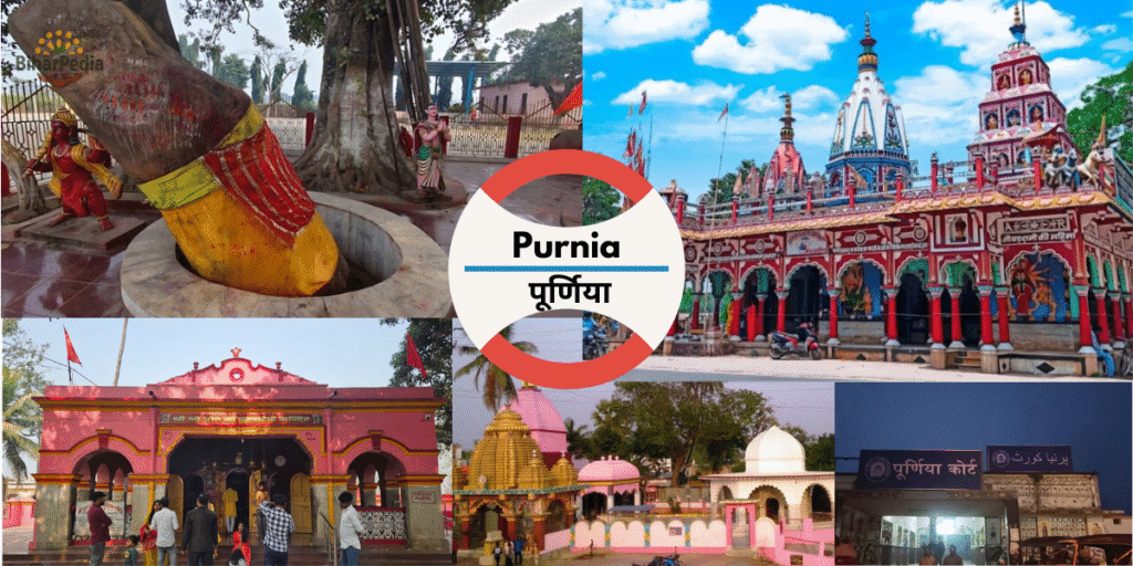
- Rani Sati Mandir (Purnia city): A revered temple dedicated to Rani Sati, attracting devotees during Navratri and special pujas.
- Puran Devi Mandir (Purnia city): An ancient Durga temple, a major pilgrimage site during Durga Puja.
- Pir Baba Mandir (Purnia): A dargah revered by Muslims and Hindus, symbolizing communal harmony, especially during Urs.
- Narsingh Avtar Kothi (Purnia): A colonial-era mansion with historical significance, linked to British administrative control.
- Qila of Jalalgarh (Jalalgarh): An 18th-century fort built by Afghan rulers, showcasing Mughal architecture and offering historical insights.
- Kajha Kothi (Purnia): A British-era administrative building, now a heritage site reflecting colonial governance.
- Kali Mandir (Purnia): A prominent temple dedicated to Goddess Kali, popular during Kali Puja.
- Dhimeshwar Temple (Banmankhi): A Shiva temple (Mahadev) in Banmankhi, a key pilgrimage site during Shivratri.
- Additional Attractions:
- Mata Asthan (Purnia): A historic temple dedicated to a local deity, frequented by devotees.
- Line Bazaar (Purnia): A bustling market area with colonial-era buildings, ideal for cultural exploration.
- Kosi River Ghats: Used for Chhath Puja and religious rituals, offering scenic views.
- Banmankhi Bird Sanctuary: A lesser-known wetland near Banmankhi, home to migratory birds like Siberian cranes.
- Purnia Air Force Station: While not a tourist site, its historical significance (established during World War II) adds to the district’s strategic allure.
- Dhamdaha Wetlands: Popular for birdwatching and pisciculture tours.
- Baisi Rajbari: Ruins of a zamindar palace, reflecting Purnia’s feudal past.
- Nearby Attractions:
- Katihar (50 km): Kamakhya Temple, Kali Bari.
- Kishanganj (80 km): Tea gardens, Gandhi Peace Foundation.
- Bhagalpur (100 km): Vikramshila University ruins.
- Siliguri, West Bengal (120 km): Gateway to Darjeeling and Sikkim.
- Tourism Support: The Purnia Municipal Corporation, under the Bihar Municipal Act of 2007, promotes tourism through urban beautification, maintenance of sites like Rani Sati Mandir, and cultural events like Chhath Mahotsav, per the Twelfth Schedule (e.g., cultural promotion and urban planning).
6. Important Statistical Data
- Area: 3,229 sq. km, supporting agriculture, urban centers, and wetlands.
- Headquarters: Purnia, a commercial and administrative hub.
- Population: 32,64,619 (2011), comparable to countries like Uruguay or U.S. states like Connecticut.
- Urban population: ~12% (Purnia city: 282,248).
- Growth rate (2001–2011): 28.33%.
- Density: 1,011 persons/km², moderate for Bihar, reflecting rural dominance.
- Literacy Rate: 51.08% (male: 59.06%, female: 42.37%), among Bihar’s lowest, with a significant gender gap.
- Sex Ratio: 921 females/1,000 males, slightly below national norms.
Additional Data:
- Scheduled Castes: 12.87%.
- Scheduled Tribes: 4.65% (higher than most Bihar districts due to Santhal and other tribal communities).
- Languages: Hindi, Maithili, Urdu, Bengali, Santhali.
- Urban Bodies: Purnia Municipal Corporation (46 wards, with 50% reservations for women, SC/ST, OBC) and nagar panchayats like Banmankhi and Kasba, per the Bihar Municipal Act of 2007.
7. Culture and Society
- Language: Hindi, Maithili, and Urdu dominate, with Bengali spoken near West Bengal borders and Santhali in tribal areas. Purnia’s cultural narrative includes folk songs and Sufi traditions.
- Art and Craft:
- Jute Crafts: Bags and mats, reflecting the jute industry.
- Pottery: Traditional clay items for festivals like Chhath Puja.
- Tribal handicrafts by Santhal communities, including bamboo and beadwork.
- Festivals:
- Chhath Puja: Widely celebrated along Kosi and Mahananda ghats, a cultural hallmark.
- Durga Puja: Draws devotees to Puran Devi and Rani Sati Mandir.
- Kali Puja: Significant at Kali Mandir, with vibrant processions.
- Urs: Celebrated at Pir Baba Mandir, fostering interfaith harmony.
- Diwali, Holi, Eid, Makar Sankranti.
- Cuisine:
- Bihari staples: litti-chokha, sattu paratha, khichdi, dalpuri.
- Sweets: thekua, khaja, balushahi.
- Banana-based dishes and fish curries, reflecting local produce and pisciculture.
- Social Challenges:
- Low literacy (51.08%), especially among females (42.37%), and rural poverty.
- Flooding from Kosi and Mahananda disrupts livelihoods, particularly for tribal communities.
- The Purnia Municipal Corporation addresses slum improvement, public health, and education, per the Twelfth Schedule.
8. Economy and Infrastructure
- Economic Role:
- Purnia’s economy is anchored by agriculture, jute processing, and trade with West Bengal and Nepal.
- Purnia city and Banmankhi are trade hubs, with markets like Bhatta Bazaar and Line Bazaar for jute, bananas, and fish.
- The district’s proximity to international borders supports cross-border commerce, particularly in agricultural goods.
- Infrastructure:
- Transportation:
- Rail: Purnia Junction and Banmankhi are key stations on the Barauni-Katihar line, connecting to Patna (7 hours), Kolkata (10 hours), and Siliguri (3 hours).
- Road: On NH-27, NH-31, and NH-131A, linking to Katihar (50 km), Patna (300 km), and Siliguri (120 km). Buses, taxis, and e-rickshaws are common.
- Air: Purnia Airport (Chunapur Air Force Station) is primarily military but handles occasional civilian flights. Nearest commercial airports are Bagdogra (Siliguri, 120 km) or Patna (300 km).
- Local Transport: Cycle-rickshaws and shared autos in Purnia and rural areas.
- Digital Infrastructure: The district website (http://purnea.nic.in) offers e-governance services like tenders, voter registration, and flood alerts.
- Healthcare: Government Medical College and Hospital, Purnia, Sadar Hospital, and private clinics. Katihar’s facilities are accessible for advanced care.
- Urban Development: The Purnia Municipal Corporation manages urban planning, waste management, and infrastructure, funded by taxes and grants. Purnia is part of the Smart Cities Mission, with projects like smart roads and Kosi riverfront development.
- Transportation:
9. Education
- Universities:
- Purnia University: Established in 2018, offering arts, science, and commerce programs.
- Purnia College: A prominent institution for undergraduate studies.
- Other Institutions: G.L.M. College, Banmankhi, M.L. Arya College, Kasba, and schools like Zila School Purnia.
- Vocational Training: Centers for jute processing and pisciculture skills, supporting rural youth.
10. Recent Developments
- Tourism Infrastructure:
- Upgrades to Jalalgarh Fort and Puran Devi Mandir, with better lighting and visitor facilities, ahead of Durga Puja 2025.
- Promotion of Purnia as part of the Seemanchal Tourism Circuit with Katihar and Kishanganj.
- Industrial Growth:
- Jute Processing Cluster planned to modernize mills and boost exports.
- Expansion of banana and makhana processing units, supported by BIADA.
- Infrastructure:
- Purnia-Siliguri Economic Corridor: Enhanced with road and rail upgrades for trade.
- Smart City Projects: Include CCTV surveillance and Kosi riverfront beautification in Purnia.
- Environmental Efforts:
- Wetland conservation in Banmankhi to protect migratory birds.
- Flood mitigation through Kosi embankment strengthening.
11. Challenges
- Flooding: Kosi and Mahananda rivers cause severe annual floods, disrupting agriculture and infrastructure.
- Socioeconomic Issues: Low literacy (51.08%), especially among females (42.37%), and poverty in rural and tribal areas.
- Border Issues: Proximity to Nepal and Bangladesh brings smuggling concerns, managed by border forces.
- Urban Congestion: Purnia city’s growth strains civic amenities, addressed by the Municipal Corporation.
12. Practical Information for Visitors
- Best Time to Visit: October–March (8–25°C), ideal for temple visits and historical exploration.
- Languages: Hindi, Maithili, Urdu, Bengali; English understood in Purnia city.
- Shopping: Jute products, bananas, and tribal handicrafts at Bhatta Bazaar or Banmankhi Market.
- Cuisine: Litti-chokha, thekua, fish curries at eateries like Purnia Bhoj.
- Accommodation: Hotel Kuber, Sita Guest House, budget lodges in Banmankhi.
- Helplines: Police (100), ambulance (108), district administration ([email protected]).
- Tourist Support: Bihar Tourism office (0612-2225411) or Purnia Municipal Corporation.