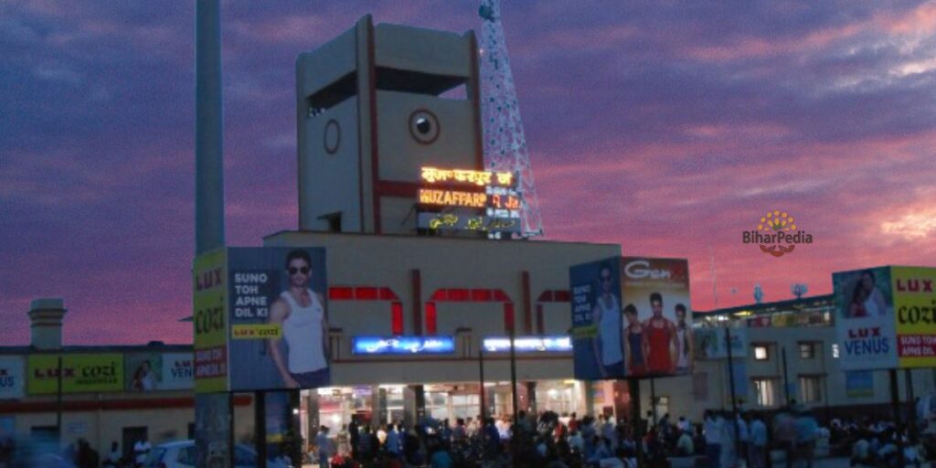
Muzaffarpur: The Land of Shahi Litchi
Muzaffarpur, the fourth most populous city in Bihar, is the headquarters of Muzaffarpur District and Tirhut Division, nestled along the Burhi Gandak River. Renowned as the Litchi Kingdom, it produces the Shahi Litchi, a Geographical Indication (GI)-tagged fruit. A key trade, educational, and cultural hub in North Bihar, Muzaffarpur blends historical significance with modern growth, featuring landmarks like Garib Sthan Mandir and institutions such as Babasaheb Bhimrao Ambedkar Bihar University. The Muzaffarpur Municipal Corporation, the first in Bihar, underscores its pioneering role in urban governance.
1. Formation of Muzaffarpur District
- Year and Reason: Muzaffarpur district was established in 1875 by bifurcating the larger Tirhut district for administrative convenience. The Tirhut district, encompassing much of north Bihar, was unwieldy due to its size and population, necessitating the creation of smaller, manageable administrative units.
- Historical Context:
- During British colonial rule, Tirhut was a significant region under the Bengal Presidency. The decision to split Tirhut into Muzaffarpur and other districts was driven by the need for efficient governance, revenue collection, and law enforcement.
- The district was named after Muzaffar Khan, a revenue officer (amil) under British administration, reflecting the colonial practice of naming regions after local administrators.
- In 1972, Muzaffarpur district was further reorganized, with Sitamarhi and Vaishali carved out as separate districts to streamline administration.
- Administrative Evolution:
- Muzaffarpur became the headquarters of the Tirhut division, which now includes six districts: Muzaffarpur, East Champaran, West Champaran, Sitamarhi, Sheohar, and Vaishali.
- The district is divided into three subdivisions (Muzaffarpur Sadar, East, and West) and 16 development blocks, including Musahari, Bochahan, and Aurai.
2. Location and Geography
- Geographical Boundaries:
- North: East Champaran and Sitamarhi districts.
- East: Darbhanga and Samastipur districts.
- South: Vaishali district.
- West: Saran district.
- Muzaffarpur is strategically located in north-central Bihar, approximately 75 km from Patna and 64 km from Darbhanga, making it a key hub in the Tirhut region.
- Rivers:
- The district is crisscrossed by several perennial rivers, contributing to its fertile soil but also causing frequent flooding:
- Gandak: Originates in Nepal and flows through north Bihar.
- Burhi Gandak: A major river passing through Muzaffarpur city, originating from the Someshwar Hills.
- Bagmati: Flows from Nepal, contributing to the district’s irrigation and flood risks.
- Lakhandayee: A smaller but significant river supporting agriculture.
- These rivers make Muzaffarpur part of the fertile Indo-Gangetic plains but expose it to annual monsoon flooding, a persistent challenge.
- The district is crisscrossed by several perennial rivers, contributing to its fertile soil but also causing frequent flooding:
- Topography:
- The district lies at an average elevation of 47 meters (154 feet) and spans 3,172 square kilometers of alluvial plains, ideal for agriculture.
- It lacks significant forest cover, with land primarily used for cultivation and settlements.
- Seismic Risk:
- Muzaffarpur is in a highly active seismic zone (Zone V), with historical damage from the 1934 Bihar-Nepal earthquake, which underscores the need for disaster-prepared infrastructure.
3. Industries and Agriculture
Muzaffarpur is an economic powerhouse in North Bihar, driven by agriculture and a growing industrial base.
- Industries:
- The district hosts a mix of traditional and modern industries, contributing to its economic vitality:
- Sugar Mills: Muzaffarpur has several sugar mills processing sugarcane, a major crop in the region.
- Thermal Power Station: The Kanti Thermal Power Station (operated by NTPC) is a significant energy provider.
- Bharat Wagon and Engineering Ltd.: A public-sector unit manufacturing railway wagons and other equipment.
- Pharmaceuticals: Companies like IDPL (Indian Drugs and Pharmaceuticals Ltd.) have units in the district.
- Gas Cylinder Factory: Supports industrial and domestic gas distribution.
- Other Industries: Include agro-based units (e.g., food processing), jute manufacturing, cutlery, and leather products.
- Recent Developments:
- A Mega Food Park promotes agro-processing, leveraging the district’s agricultural output.
- A Leather Product Park and India’s largest bag manufacturing cluster are boosting industrial growth.
- Biofuel plants, textile units, and a semiconductor firm signal Muzaffarpur’s emergence as an industrial hub.
- Prabhat Zarda Factory and Sudha Dairy are notable for tobacco and dairy products, respectively.
- The district hosts a mix of traditional and modern industries, contributing to its economic vitality:
- Agriculture:
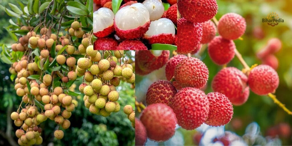
- Muzaffarpur is globally renowned as the “Land of Lychee”, producing 300,000 tonnes annually across 25,800 hectares. The Shahi lychee, with its Geographical Indication (GI) tag, is a premium variety exported to major Indian cities and abroad. Bihar accounts for 40% of India’s lychee production, with Muzaffarpur as the epicenter.
- Other important crops include:
- Paddy, maize, and wheat: Staple grains grown on fertile plains.
- Lentils: A key pulse crop.
- Mango: Including varieties like Jardalu, also GI-tagged.
- The National Litchi Research Centre in Muzaffarpur supports research and farmer training, though its maintenance has faced criticism.
- Challenges include limited global market penetration for lychees (India’s share is <1%) and flood-related crop losses.
4. Tourism
While not a primary tourist destination, Muzaffarpur offers a mix of religious, historical, and natural attractions, drawing visitors interested in culture and agriculture.
- Key Tourist Places:
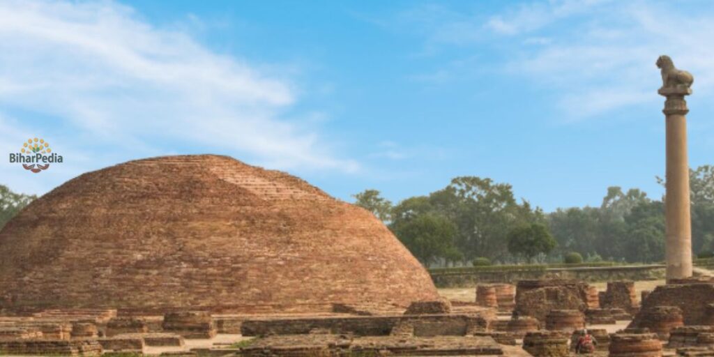
- Kolhua (Ashokan Pillar, Vaishali): Located 32 km south in Vaishali, this site features an Ashokan pillar and ancient Buddhist stupas, reflecting the district’s historical ties to the Vajjika League and Buddhism.
- Garib Sthan Mandir: A 13th-century Sufi shrine dedicated to Hazrat Makhdoom Syed Shah Ruknuddin Alam, revered by Hindus and Muslims alike for its spiritual significance.
- Ramna Kali Temple (Maa Ramna Devi Mandir): A historic Durga temple attracting devotees, especially during Navratri.
- Kamal Shah Mazar: A lesser-known but culturally significant tomb, reflecting Muzaffarpur’s syncretic heritage.
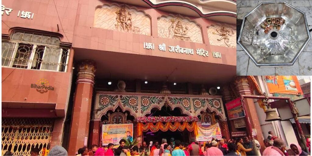
- Baba Garibnath Temple: A prominent Shiva temple with a historic Shivling, drawing large crowds during Shivaratri and hosting a cattle fair in Aurai block.
- Litchi Gardens: Over 200 acres of orchards with 50,000 trees, offering a unique agro-tourism experience during the lychee season (May–June).
- Ramchandra Shahi Museum: Established in 1979 in Jubba Sahni Park, it houses sculptures, coins, artifacts, and paintings, honoring freedom fighter Ramchandra Shahi.
- Khudiram Bose Memorial: Marks the 1908 Muzaffarpur Bomb Case, a pivotal event in India’s independence struggle.
- Motijheel: A British-era reservoir turned public park, ideal for relaxation.
- Jubba Sahni Park: A family-friendly park with a low entry fee (₹10).
- Nearby Attractions:
- Vaishali (32 km): Birthplace of Lord Mahavir and a Buddhist pilgrimage site.
- Sitamarhi (60 km): Associated with Sita’s birthplace in Hindu mythology.
- Nalanda and Rajgir (120–150 km): UNESCO World Heritage Sites with Buddhist and historical significance.
- Janakpur, Nepal (87 km): A cultural and religious destination linked to the Ramayana.
- Best Time to Visit: October to March, when temperatures range from 6°C to 20°C, ideal for exploring temples, parks, and orchards.
5. Important Statistical Data
The statistical data you provided is consistent with the 2011 census and other sources. Here’s a detailed breakdown with context:
- Area: 3,172 sq. km (slightly varies in some sources as 3,175.9 sq. km due to boundary adjustments).
- The district’s compact size supports dense agricultural and urban activity.
- Headquarters: Muzaffarpur, the largest city and administrative center.
- Population: 48,01,062 (2011 census).
- Comparable to countries like Singapore or U.S. states like Alabama.
- Urban population: 9.76% (Muzaffarpur city: 354,462).
- Growth rate (2001–2011): 28.14%, indicating rapid demographic expansion.
- Density: 1,514 persons per sq. km, reflecting high population pressure on resources.
- Literacy Rate: 63.43% (male: 71.28%, female: 54.67%).
- Below the national average, with a notable gender gap, highlighting educational challenges.
- Sex Ratio: 900 females per 1,000 males, slightly below the national average, indicating gender imbalance.
Additional Data:
- Scheduled Castes: 15.66% of the population.
- Scheduled Tribes: 0.12%, a negligible proportion.
- Languages: Vajjika (39.02%), Hindi (48.33%), Urdu (7.65%), Bhojpuri (3.54%).
- Urban Bodies: Muzaffarpur Municipal Corporation (49 wards) and nagar panchayats like Kanti and Motipur.
6. Culture and Society
Muzaffarpur’s cultural landscape is shaped by its historical role as a crossroads of Hindu, Muslim, and Nepali influences.
- Language:
- Vajjika, a dialect of Maithili, is the primary language, spoken by 39.02% of residents. Hindi dominates official and urban communication.
- Maithili literature and folk songs enrich the cultural fabric.
- Art and Craft:
- Lahti Bangles: Muzaffarpur’s lac bangles are a cultural hallmark, gaining fame through Bollywood (e.g., worn by Aishwarya Rai at her wedding).
- Handicrafts and agro-based products are also significant.
- Festivals:
- Chhath Puja is the most prominent festival, celebrated with devotion along riverbanks.
- Other festivals include Diwali, Holi, Durga Puja, Eid, and Makar Sankranti.
- The Shivaratri cattle fair at Bhairav Nath temple is a major cultural event.
- Cuisine:
- Bihari staples like litti-chokha, kadhi bari, ghugni, choora, dhuska, and pittha dominate.
- Non-vegetarian and Mughlai dishes are popular, alongside South Indian options.
- Shahi lychee and lychee-based products (e.g., wine) are culinary highlights.
- Social Challenges:
- Despite cultural vibrancy, Muzaffarpur faces issues like poverty, low female literacy, and health crises (e.g., the 2019 Acute Encephalitis Syndrome outbreak linked to lychee consumption in malnourished children).
7. Economy and Infrastructure
- Economic Significance:
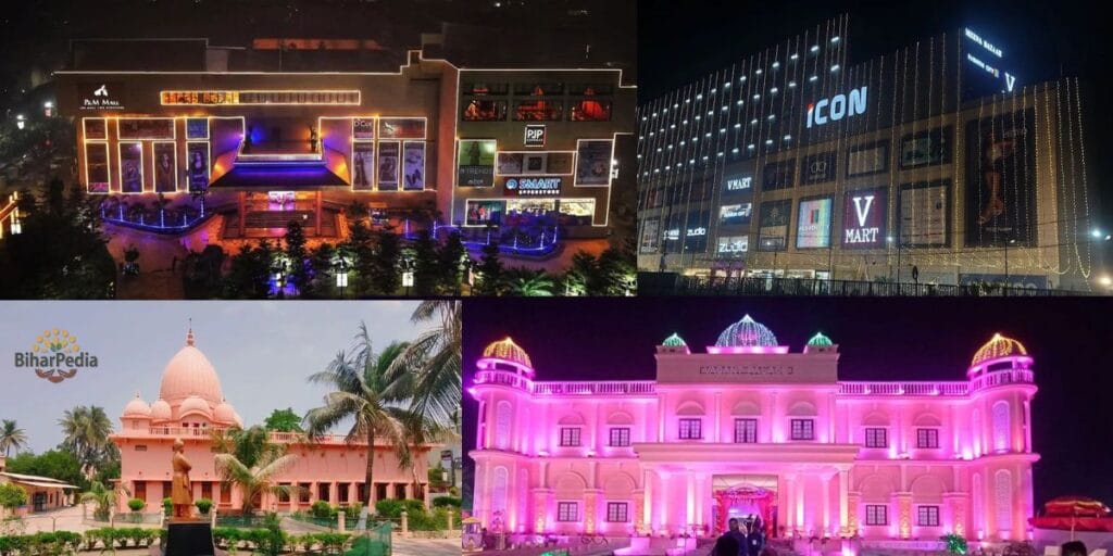
- Muzaffarpur is a commercial hub for North Bihar, serving as a wholesale market for agricultural produce, fruits, and commodities.
- Its proximity to Nepal facilitates cross-border trade, particularly in lychees and textiles.
- The Muzaffarpur Night Market is a bustling center for street food and commerce.
- Infrastructure:
- Transportation:
- Rail: Muzaffarpur Junction (MFP) is a major station on the East Central Railway, connecting to Delhi, Mumbai, Kolkata, and Varanasi. Travel time to Delhi is 18–19 hours.
- Road: Lies on NH-27 (East-West Corridor), NH-22, NH-28, NH-57, and NH-122, with connectivity to Patna (2 hours), Darbhanga, and Nepal. Recent projects include the ₹5 crore Kanti-Madwan path repair (2025).
- Air: No operational airport; nearest are Darbhanga (64 km) and Patna (75 km).
- Local Transport: Auto-rickshaws, cycle rickshaws, and taxis are common.
- Digital Infrastructure: The district website (http://muzaffarpur.nic.in) supports e-governance, offering services like tenders, voter registration, and case tracking.
- Healthcare: Sri Krishna Medical College and Hospital (SKMCH) is the primary facility, with private hospitals like Mishra Hospital. Plans for an AIIMS-like institute are in progress.
- Urban Development: The Greater Muzaffarpur initiative integrates 109 villages, enforcing strict urban planning (e.g., 20-foot-wide roads). Muzaffarpur ranks 32nd in India’s “National Clean Air City” list (Category 2).
- Transportation:
8. Education
- Key Institutions:
- B.R. Ambedkar Bihar University: Offers diverse academic programs.
- Muzaffarpur Institute of Technology (MIT): A leading engineering college.
- Sri Krishna Medical College and Hospital (SKMCH): Trains medical professionals.
- L.S. College, M.D.D.M. College, and R.D.S. College: Renowned for arts, science, and commerce.
- National Litchi Research Centre: Focuses on agricultural innovation.
- Coaching Hub: Muzaffarpur is a center for competitive exam preparation, catering to UPSC, SSC, and engineering aspirants.
9. Recent Developments
- Industrial Boom:
- The district is witnessing an industrial revolution with a Mega Food Park, Leather Product Park, biofuel plants, textile units, and a semiconductor firm.
- The bag manufacturing cluster is India’s largest, enhancing economic prospects.
- Infrastructure:
- The Greater Muzaffarpur project is transforming urban planning, with GIS-based surveys and drainage improvements.
- Road and bridge repairs, like the Kanti-Madwan path, are ongoing.
- Cultural and Agricultural Recognition:
- The Shahi lychee GI tag has elevated Muzaffarpur’s global profile.
- Lahti bangles continue to gain cultural prominence.
- Environmental Efforts:
- Muzaffarpur’s clean air ranking reflects progress in pollution control, supported by state initiatives.